Please share!
This is a big riding weekend. We’ve seen tons of trailers coming up. We want EVERYONE to come enjoy the Upstate Snow… but more importantly GO HOME SAFELY! Please take note of the following:
1) It’s been an up and down year for riding. For many this could be their last shot of the season, especially those that travel from NYC area or out of state. PLEASE SLOW DOWN! The trails are A LOT ICIER THAN USUAL! With frequent freeze thaw events, and lots of sleet and freezing rain mixed into the snowpack… always assume ice under you and at every turn. Excessive speed can turn in into a slingshot down an embankment and/or into a tree.
2) WATCH THE LAKES! The freeze thaw cycles have produced A LOT of ICE HEAVES on popular lakes to cross like Sacandaga, Great Scandaga Reservoir, Lake Pleasant, Raquette and others.
3) Ride Defensively! Tons of events, lots of snow, tons of sleds. Assume someone is going to come at you on your side around a corner. If you’re ready for it… and are riding safe a right yourself… you increase the chances of avoiding a collision or if one is not avoidable, surviving it!
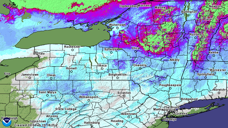
So what about riding areas? North of the Mohawk Valley (Thruway) from Syracuse area to Albany is where it’s at. There are limited opportunities on local trails in CNY in parts of Otsego, Chenango, Madison, Cortland and Onondaga Counties mainly in the highest elevations. Wherever you go, always check directly with clubs first, respect the landowners and stay on the trail. I know… we’re preaching to the choir for the most part.
So what about riding beyond the holiday weekend? The mid to late week storm next week is of concern for going warm and wet. This winter you know what that means. Your prime riding conditions are this weekend and through Wednesday of next week. After that all bets are off. Looking farther beyond, models are all over the place. We don’t even want to speculate right now… but all we will say scientifically is this… the groundhog is unfortunately on to something. If you’ve noticed the west has been stormy and cold. Usually that means we are warm… like today in the 40s to low 50s briefly… but what has saved us are two things: 1) Ridge in Alaska feeding Siberian air into Canada and 2) The Newfoundland Low, or 50/50 (for 50 N 50 E lat/lon), that traps the cold air into Quebec, eastern Ontario and us. That’s what’s saving us from another full meltdown through Wednesday… but if this breaks down at any time, either of these pieces… with stormy and cold weather parked out west… it means we could be wiped out fast and early for the season by early March.
Key word: COULD. We are simply telling you the potential is there… and it’s mid February… if you want to ride, stop making excuses and GO. If you wait, in three to four weeks it may be it. March can always surprise us like last year, but it’s not a guarantee.
So with all that being said… Here’s the outlook for the holiday weekend…
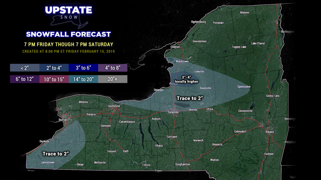
Temperatures will continue to fall through the night, and a band of lake effect snow is expected to come together off of Lake Ontario. There will be some snow showers off of Lake Erie as well but nothing exciting. Winter Weather Advisories are up for Jefferson, Lewis, and Oswego counties, with the Tug Hill being the winner at 2-4 or perhaps 3-5 inches of new snow.
Elsewhere just a few scattered snow showers through 7 PM Saturday.
Quiet conditions will prevail Saturday afternoon through Sunday before our next system slides just off to our south; this will throw some light snows across much of the state Sunday night through Monday.


