
Good evening…
Well the warmth was … brutal today. No two ways about it. High temps well into the 60s in quite a few areas today.
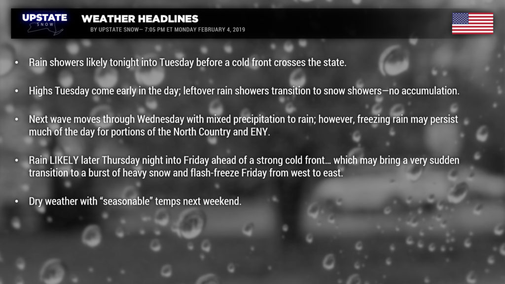
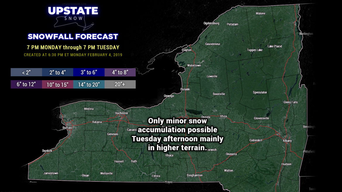
Obviously there’s very little accumulating snow in our forecast over the next 24 hours. Rain showers are expected to break out from west to east later this evening, with the brunt of the rain coming during the overnight hours into Tuesday morning. The rain isn’t expected to be all that heavy or significant… modeling paints the Tug Hill with the most liquid equivalent, just under half an inch of rainfall. Why the Tug? For the very same reason the Tug got the enhanced snowfall during our lake effect storm — enhancement thanks to terrain and that upsloping. At any rate, the vast majority of us will see up to a couple tenths of an inch of rain through 7 PM Tuesday… areas east and south of I-88 probably won’t see much in the way of rainfall at all. As our cold front moves across the state tomorrow, we’ll see our temperatures fall… especially over western New York, where “highs” will occur early in the day (i.e., before sunrise, and in the lower 40s), with numbers falling as we go through the day. The warmest temps on Tuesday will occur in the southern Catskills and lower Hudson valley, with readings into the mid and upper 50s. Any leftover rain showers in the central and western part of the state transition over to some snow showers, but no real accumulation should come from this.
Temperatures fall back into the teens and lower 20s across the state Tuesday night with dry conditions.
Our next weather system takes aim on the Upstate as we go into Wednesday. Models show mixed precipitation moving in to WNY after sunrise and progressing eastward through the day. This system will cross the state in a hurry, and will flood enough warm air that mixed precipitation / freezing rain should transition to rain… but since we’re going to start out cold early Wednesday (remember… teens and lower 20s), that colder air may remain locked in place for the North Country and the Catskills… and if we believe our high-res modeling, “advisory level” mixed precipitation or freezing rain may be a good bet for much of ENY Wednesday afternoon. Regardless, warm air will win the war and everyone goes over to showers of rain by Wednesday night into Thursday morning. The forward speed of this system, and the fact that warmer air will be pumping northward, should keep us from seeing a “major” icing event.
The next system in the parade will arrive Thursday. There may be a respite for a little while during the day, but we’ll be greeted once again with very mild air over the state. There are still some differences in opinion regarding the rain potential Thursday afternoon and night ahead of a very strong cold front… which means the devil once again is in the minute details. However, the “big picture” shows yet ANOTHER low lifting north through the Great Lakes into Canada. This one looks to be the strongest of the bunch this week, and as been our cruel pattern this winter, these have been heavier rainmakers than the modeling suggested. Therefore we’re going to lean toward… not necessarily a “heavy” rain event, but we’ll call it… “heavier than what the models tell us.” Maybe we’ll be pleasantly surprised if most of the dynamic lifts north. At any rate, expect rain Thursday night into Friday ahead of a kicker cold front. Rain will come to an end as the front passes… BUT… as temperatures nosedive there may be a burst of heavy, wet snow with the front itself. We don’t expect that it will be a lot of snow, but it may be the kind that really disrupts travel because we’ll go from rainy, mild weather, to a snow squall, followed by potentially something of a flash-freeze.
As mentioned, temps fall Friday afternoon… and as the cold air “deepens” (gets thicker and thicker in the atmosphere), look for some lake effect to get going, especially east of Lake Ontario. As mentioned, this low looks like it will be the strongest of the bunch this week, and as it develops Braun Strowman-like strength, we’ll likely get some pretty strong winds, especially across central and western NY Friday afternoon into Friday night.
Unlike the last lake effect storm, this one will be very short lived (if we could even call it a “storm” in the first place). High pressure settling in will bring an end to any lake effect by early Saturday morning… and we’ll be looking at dry conditions with seasonable temperatures for the weekend.
There are some indications that “real” snow chances could return NEXT week but absolutely no modeling agreement… and given how things have been this winter … up and down … we’re not going to even attempt to make any kind of call on that.
As always, we know these wild swings in weather patterns are frustrating. It’s the hand we’ve been dealt. “Don’t shoot the messenger.” We always appreciate your viewing and checking out our sponsors. Thanks again, and we’ll catch you tomorrow.


