Good evening!
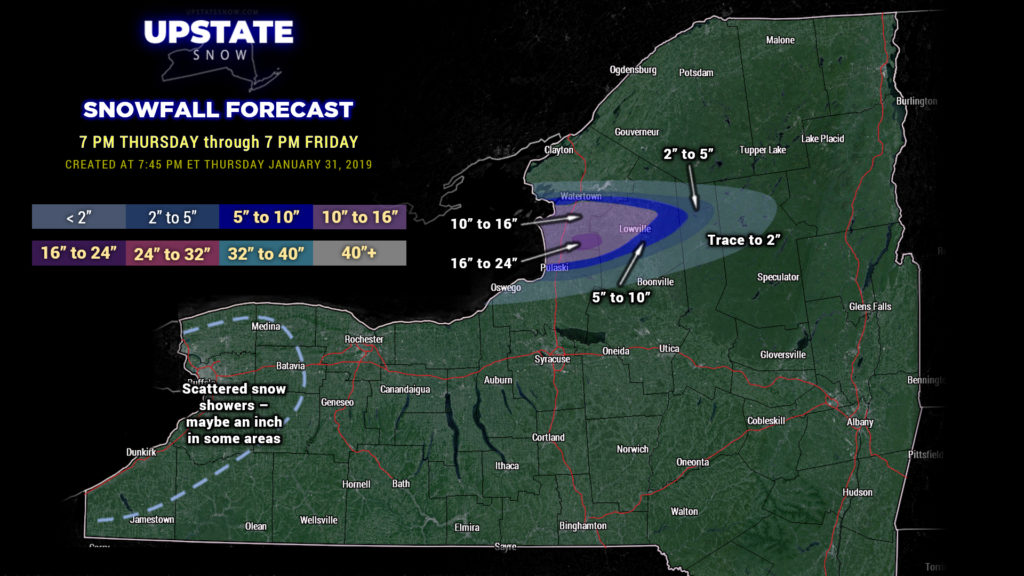
Lake effect snow continues to impact areas east of Lake Ontario… and this will continue:
Jefferson-Lewis-
619 PM EST THU JAN 31 2019
…A BAND OF INTENSE LAKE EFFECT SNOW WILL AFFECT CENTRAL JEFFERSON AND NORTHERN LEWIS COUNTIES…
At 617 PM EST, A band of intense lake effect snow producing snow fall rate of 3 to 4 inches per hour or more will remain nearly stationary through early evening from Watertown to Harrisville. This band of very heavy snow is expected to begin moving slowly south around mid evening.
Winds in excess of 30 mph are occuring in and near this band of lake effect snow, creating whiteout conditions. Travel will be nearly impossible within this band of heavy lake effect snow.
Locations impacted include…
Watertown, Fort Drum, Stony Point, Carthage, West Carthage, Adams, Dexter, Glen Park, Herrings, Adams Center, Henderson Harbor, Denmark, Sackets Harbor, Henderson, Black River, Smithville, Philadelphia, Rodman, Brownville and Copenhagen.
This includes Interstate 81 between exits 41 and 48, and Route 3 from Watertown to Harrisville.
If you must travel, be prepared for severe winter driving conditions with near zero visibility and deep snow cover on roads.
That’s really the only game going on as far as new snowfall goes. Maaaayyybe a trace of snow in some renegade snow showers off of Lake Erie, but all eyes are east of Lake Ontario. The snow band will drift slowly back to the south and drop another couple of feet of snow on the Tug during the overnight. High pressure building in will rapidly choke out the plume off of Lake Ontario Friday… with just scattered snow showers by Friday afternoon.
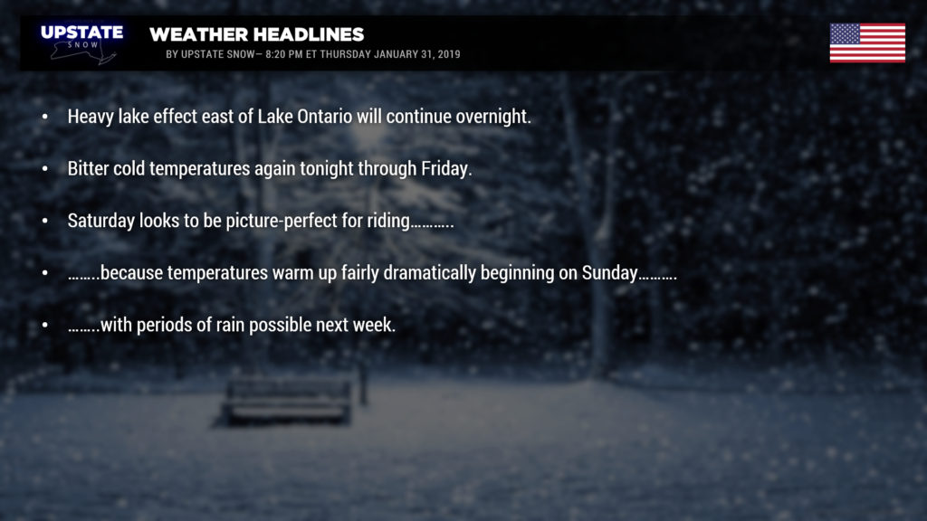
If you’re going to ride on this bounty, Friday and Saturday are your best days. It’s still going to be cold on Friday… high temperatures will be in teens statewide, save for the North Country with single digits above zero. Wind chill warnings are still posted through Friday morning for Sullivan, Otsego, and Delaware counties, where chills down to 30 below zero are expected; wind chill advisories are posted through Friday morning elsewhere, for wind chills to 15 below zero.
Temperatures moderate a lot for your Saturday — mid to upper 30s across the Fingerlakes and western New York, around 30 to the lower 30s for the Susquehanna Region, mid to upper 20s for the North Country.
Then…. Nature will be cruel to us once again. For Sunday, looking at highs into the lower 40s across the Southern Tier, Fingerlakes, Western NY, around 40 Susq. region, and in the 30s for the North Country. Lower to middle 50s for much of the Fingerlakes and western NY for Monday. By Monday a warm front will lift north across the state, and this may produce some rain or mixed precipitation as it moves through … not a lot though. Models still have a lot of disagreement on the impact of the next system. On the whole, low pressure will move to our west and north and drag a front across the state Tuesday. There are questionmarks on how much rain will come ahead of this frontal passage… the FV3-GFS showing “not much,” while the GFS shows a considerable batch of rain on Tuesday. The Canadian doesn’t show this frontal boundary crossing the state until the end of next week… leaving unseasonably warm temps across the state into next FRIDAY. Ugh.
A “gut instinct” forecast is that a cold front crosses the area Tuesday, with some rain likely ahead of it. The low passes to our north and west, and as it strengthens, this would mean gusty winds. As of right now it doesn’t look like the rain amounts will be all that impressive, but we said that before and got burned, so… there’s that thought as well. Anyway, a second area of low pressure looks like it will follow on the heels of the first one, in virtually the same direction, lifting more warm temperatures across the for the mid-week period… and the European model especially points to this as being a pretty rainy weather system.
By the end of NEXT week, though, the modeling suggests temperatures and weather conditions return to typical February levels.
How much of our snow is going to disappear this week? It could be a fair bit… hard to really tell at this point, especially given model inconsistency. If you’re going to ride, as we are, tomorrow and Saturday look to be prime. Just be safe, pay attention, and be smart.
Thanks for viewing!


