Good evening!
First off, we have a Flash Flood Watch up for Niagara and northern Erie counties for an ice jam on the Upper Niagara River near the North Grand Island Bridge. The water level is stable, but still just below the level where inundation and damage begins. If the ice jam grows flooding may develop. Areas susceptible to flooding from rising water on the Upper Niagara River include the Grand Island shoreline, Cayuga Island in Niagara Falls, and the river shoreline between North Tonawanda and Niagara Falls.
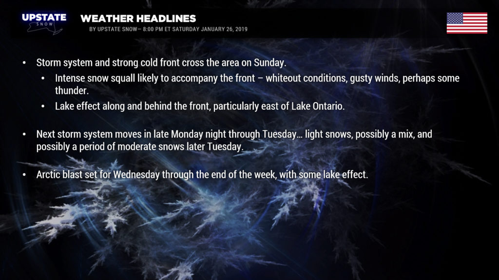
Ok… that’s out of the way. A storm system will lift just northeast of us on Sunday, dragging a cold front across the state. Generally light snows are expected with this… but some heavier snows are possible in the far North Country closer to the surface low… as well as the potential for an intense snow squall along the front itself… similar to the way we would get strong thunderstorms accompanying cold fronts in the warm season.
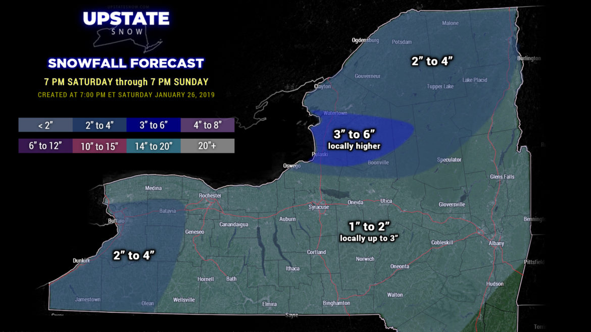
Winter Weather Advisories are up for Oswego, Jefferson, and Lewis counties through Sunday for narrow bands of heavier snows and gusty winds impacting the eastern Lake Ontario region. These lake bands and gusty winds will come after the frontal passage. Lake Erie won’t have quite as robust of a response, but still a nice layer of new snow for you guys as well.
Looking at our snow map, MOST areas will receive a general 1-2 / 1-3 inches of snow. Higher amounts along the Chautauqua Ridge, as well as east of Lake Ontario (particularly the Tug) and the North Country.

We mentioned the snow squall in advance of or along the frontal boundary. This is an interesting scenario from a scientific standpoint, lots of ingredients coming together … in short it wouldn’t be a surprise to hear some thunder in the squall. The squall is expected to be very intense, with brief whiteout conditions and very gusty winds making travel … exceedingly difficult for a short period of time. The VAST MAJORITY of the snow you see on our map will occur with this squall/frontal passage.
Timing — this is a bit tricky… but the HRRR model shows the front across western NY, from Rochester to Olean, by around 8 AM tomorrow morning… advancing toward the I-81 corridor by 11 AM (ish), and then orienting from roughly Binghamton to Speculator to Burlington by 2 PM… and the Capital District by 5 PM. Again, the times are approximate and based on the latest high-res modeling… this could change.
Lake Ontario-effect snow continues into Sunday evening before tapering off after midnight.
Monday looks to be a dry day thanks to high pressure to our north. The next weather system then begins to approach — a clipper system that will dive south and east from the Dakotas before making a sudden turn and moving to OUR north and west…. yeah you read that properly. Light snow should develop across the state late Monday night. Temperatures will probably not fall much on Monday night as a warm front lifts south-to-north across the state. This is NOT looking like the robust rain event that we had, nor are we looking at a prolonged period of warm temperatures. Modeling suggests it will be very short lived as an Arctic front pushes west to east across the state Tuesday (later Tuesday) … and while some mixing of precipitation is possible Tuesday it doesn’t look like that’s going to be as big of a concern… at least according to the latest GFS ensembles anyway.
So our front pushes across the state Tuesday. The vast majority of the modeling we look at shows an area of low pressure developing on the front… but this time farther east (as opposed to what we had during the rain storm). This would set the stage for a period of some moderate snows Tuesday afternoon. If we believe the Euro, “shovelable” snows would occur Tuesday afternoon into the evening.
Frigid Arctic air absolutely pours into the area behind this system Tuesday night into Wednesday, which some lake effect persisting into early Thursday before we round out the work week.


