Good evening!
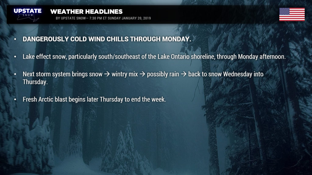
Well our storm has pulled away… a tight pressure gradient will mean a stiff north-northwest wind flow, lake effect snows, and DANGEROUSLY cold wind chills through Monday.
Looking at storm totals reported to NWS, we were pretty spot-on with our map. There was some mixing south/east which did cut down on totals, but all-in-all it was a good forecast. Now lets enjoy it! But…..
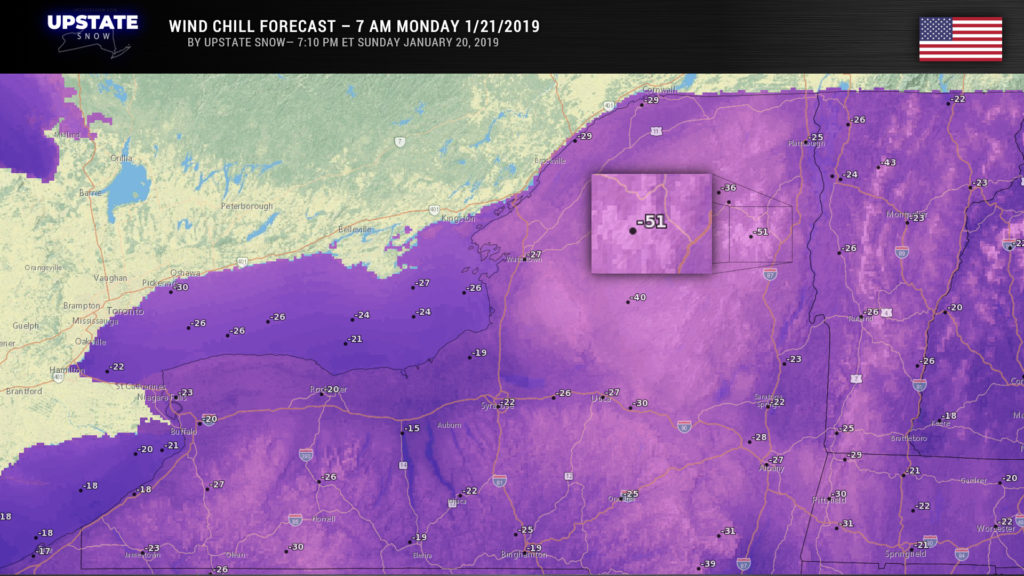
The big story is the cold. Wind Chill Warnings are up for most of the state… wind chills 35 to 45 below zero are expected through Monday. This isn’t something to take lightly folks… if you’re going outside to enjoy the snow tomorrow PLEASE make sure you’re properly protected–frostbite of any exposed skin can occur in as little as TEN MINUTES. Actual air temperatures tonight will drop to around 20 below zero for the North Country, 0 to 10 below south of the Thruway. We won’t warm up an awful lot on Monday either — highs 0 to 10 below for the North Country, 0 to 10 above south of the Thruway.
Wind chill forecast for 7 AM Monday………

Big blue high pressure settles in Monday night and temperatures tumble once again… fortunately though the wind will relax and wind chills won’t be as severe. Still… expect lows 20 to 25 below zero in some spots in the Adirondacks, otherwise 0 to 15 below just about everywhere else.
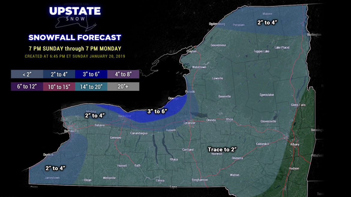
Lake effect snow: Lake effect is still expected immediately south and southeast of Lake Ontario, particularly tonight through Monday morning. An additional 2-4 inches of snow is expected, perhaps 3-6 along the shore. Elsewhere, scattered to numerous snow showers may add another couple of inches here and there. Once the high pressure settles overhead, the lake effect will end and it will just be … cold.

Then things start to change… because of course they will. The high shifts to the east and allows the next weather system to move in our direction. That big strong high pressure to our east means that the next storm system moves from the northern Plains into the Great Lakes. Look for snow to develop late Tuesday or Tuesday night — this will probably be light snow. You know by now that when systems move to our west/north a flow of warm air pushes northward… so it should come as no surprise this will happen here as well. Most of the state should go above freezing, and the snow will transition to mixed precip and then probably plain rain on Wednesday (the North Country may maintain mixed precip). Modeling wants to push in some more moisture later Wednesday into Wednesday night… but it’s anybody’s guess as to what precipitation type we’re looking at… there’s absolutely no model agreement whatsoever with regard to the precipitation and the timing of cold air pushing back in. A “persistence forecast,” based on past experiences, would indicate rain continuing into Wednesday evening. As the whole mess slowly lifts north/east, expect a changeover back to snow from west to east across the state Wednesday night. For now, that’s what we’ll go with. We’ll hopefully be able to pin this down with some more clarity by tomorrow’s report.
Colder air pulls back in on Thursday, so the whole storm system will end as snow. How MUCH precipitation falls from this event Tuesday night through Thursday… is really a tough call. While temperatures do go above freezing, we’re not looking at any huge crazy warmup…. temperatures may hit 40 in some areas of the Southern Tier on Wednesday afternoon before the next pool of Arctic air rushes into the region.
We will close out the week with a renewed Arctic blast… with very cold temps across the state once again, and a return of lake effect snow.
Again, if you’re going out to ride, please make sure you’re prepared for the cold… and be safe.
Thanks for viewing and supporting the site!


