Good evening!
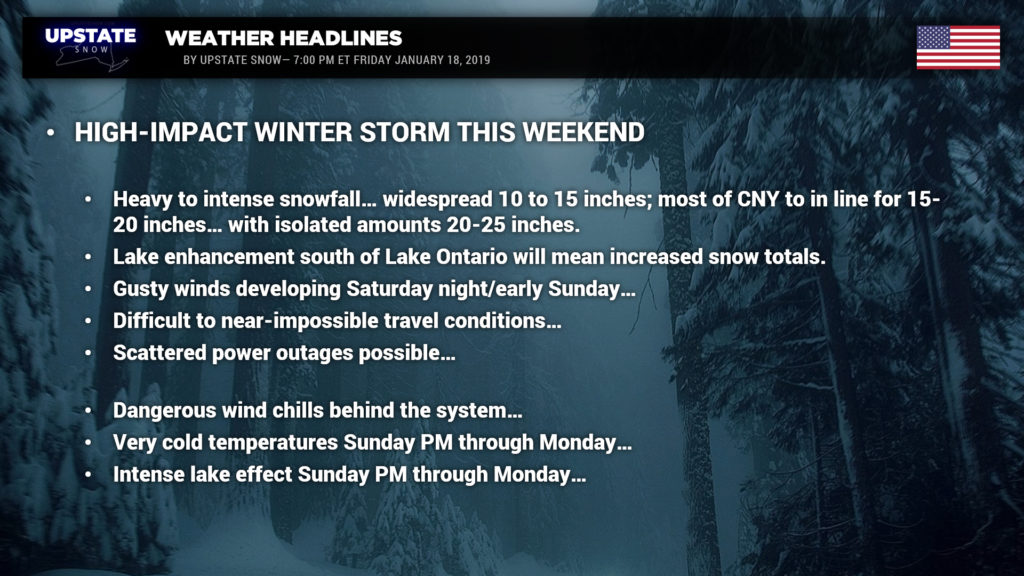
Our story tonight is Winter’s Comeback Performance. A major winter storm has all of New York set in its sights.
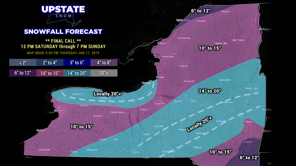
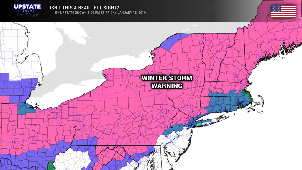
This… is a beautiful map.
Here is our STORM TOTAL SNOWFALL forecast – which runs from 12 noon Saturday through 7 PM Sunday. Almost everyone (probably everyone) will see double-digit snowfall totals from this event. We have a swath of 14″ to 20″ for the Southern Tier, the Susquehanna Region, and eastern New York. In that area as well, a deformation zone is expected to become established; we have placed it on our map here based on the latest modeling, but where it actually DOES set up (if it sets up) won’t be known until… it actually happens. Wherever that band does set up, enhanced snow totals pushing 2 feet (or more) can be expected.

We have also targeted the areas south of Lake Ontario to the Thruway for 14-20 inches. As the storm pulls off to the northeast, winds will start to HOWL from the north, and you’ll get near-perfect conditions for lake enhancement. We also put in an area for locally 20″+, and again, it wouldn’t be a surprise to see 2-foot storm totals there.
All in all this is a fantastic winter storm to bring our season roaring back to life.
Travel will become virtually impossible across the state Saturday night during the peak of the storm. If a deformation zone sets up, don’t be surprised to hear a rumble of thunder.
Gusty winds will also mean an abundance of blowing and drifting snow, leading to further whiteout conditions and near-impossibly travel continuing through Sunday.
It is going to be COLD behind this system. Temperatures will crash Sunday afternoon. When you wake up Monday morning, look for actual air temperatures to run from around 20 below zero in the North Country to between zero and 10 below south of the Thruway. Factor in the strong northwest winds that will be over the area, wind chills will be in a very dangerous category– looking at 30 to 45 below zero (if not even colder). This is no joke folks. We rejoice at the new life our season will experience, but please make sure you’re ready for this cold.
Looking into next week, we’ll be focusing on some … interesting weather … for the mid-week timeframe. Some models want to push a spike of warm temperatures in here on Wednesday; if that’s the case it’ll be short-lived. A weak-slash-moderate weather system moves off to our northwest, but the latest Euro spins up a new, rapidly deepening low pressure possibly along the coast on the heels of the original system — we’ll worry about all this next week.

