Hi everyone!
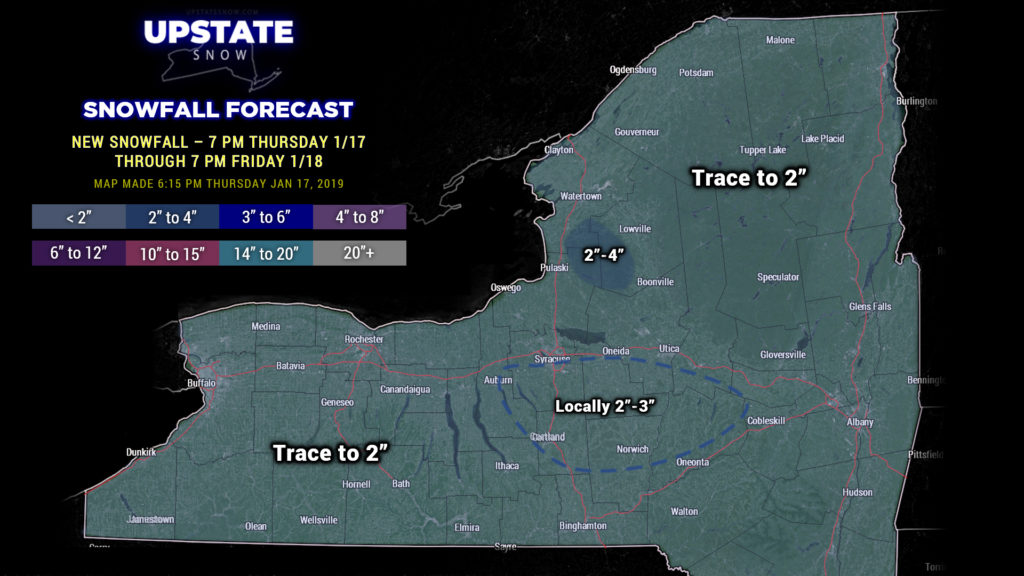
A storm system will move across the state tonight into early Friday bringing a widespread 1-2 inches of snow… perhaps as much as 3 inches in the hills along and south of Route 20, and 2-4 for the Tug Hill. That’s that.
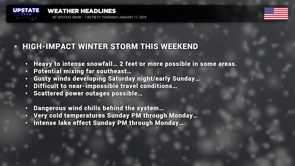
DANGEROUS WINTER STORM TO AFFECT ALL OF NEW YORK SATURDAY AFTERNOON THROUGH MONDAY.
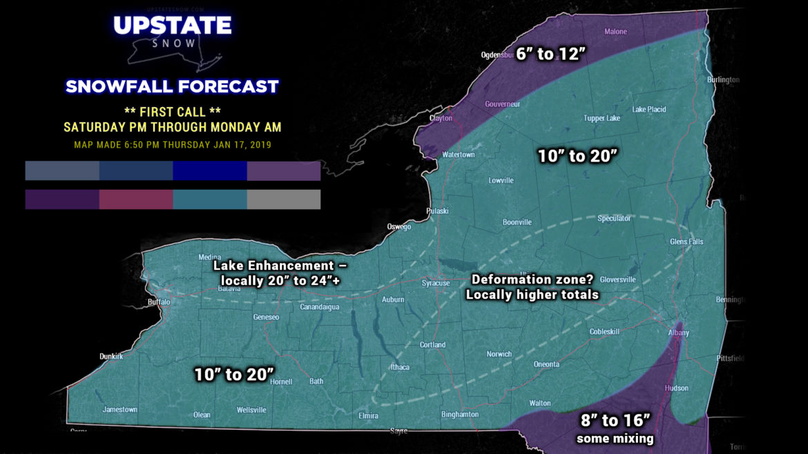
Here is our “first call” for this event. It’s actually fairly simple… and there’s no need to layer all the colors. The VAST MAJORITY of the state can expect between 10 and 20 inches of snow. Far northern sections looking at lesser amounts, but still a healthy 6-12 inches, and lesser amounts the farther south and east you go as there is still the threat for some mixing… this includes the Capital District.

As we pointed out in last evening’s blog, models are hinting at a deformation zone becoming established somewhere over CNY. Where this sets up, expect higher snow totals… it would not be surprising to see some areas pushing 30 inches. We will not know where this deformation zone will become established until the storm onset.
Snow should develop from southwest to northeast… beginning late Saturday morning for far SW NY, by late Saturday afternoon far NE. Heavy snowfall rates of 1-2 inches per hour during the overnight Saturday night… this will be the height of the storm. Snow should gradually diminish Sunday… but lake enhancement and lake effect will begin. As the storm pulls to the north and east, look for winds to increase and temperatures will absolutely plummet Sunday afternoon. This strong northerly flow will result in intense lake effect south of Lake Ontario Sunday afternoon, which will enhance storm totals in those areas.
Whiteout conditions are likely Saturday night. Travel will not be recommended unless it’s a life-or-death emergency… and may be impossible.
Now…. A YUUUUGE ASTERISK. This is a “first call” forecast. We will issue a “final call” tomorrow night. IT CANNOT BE STRESSED ENOUGH — ANY “WOBBLE” IN THE STORM TRACK COULD MEAN HUGE CHANGES IN THESE NUMBERS. We’re talking about a storm that is still pounding California as this report is being written. Remember we described the gate-hinge last night… the tiny change at the hinge means large changes at the opposite end. This is the case here.
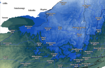
Once the winds pick up Sunday afternoon and temperatures fall, we could be looking at additional whiteout conditions from blowing and drifting snow. Wind chills will likely drop to 30 below zero or colder Sunday night / early Monday… some of the modeling suggests 40 below for the North County. Wind Chill Warnings will likely be issued. This is nothing to take lightly. It might be difficult to see it on this map below, but yes, that’s 47 below zero at Mt. Marcy.
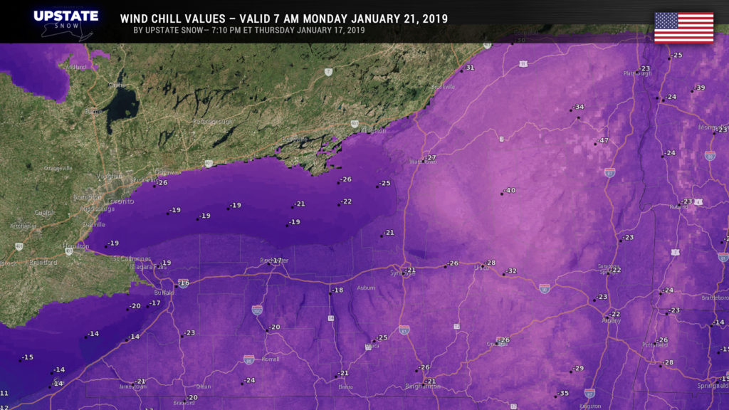
Air temps Sunday night will easily drop into the teens to possibly 20 below for the North Country, with numbers zero to 10 below south of the Thruway.
Lake effect should come to an end late Monday into Monday night as a big blue dome of high pressure shifts overhead, and once again temperatures plummet well below zero… the numbers you get early Tuesday morning will be right around what you’ll have early Monday morning. Highs on Monday — 10 below to 5 above for the North Country, zero to 10 above south of the Thruway.
Looking longer-term beyond this event, there is a lot of uncertainty as we head into the middle of next week. Models demonstrate another vigorous system may impact the northeast… there are some differences… big differences… on placement of the surface low and how much warm air pumps into our direction (right now we think this will be another snow event)… so this will bear careful watching.

